How to read marine navigational markers and buoys.
Marine Navigational Markers & Their Meanings: A Complete Guide for Boaters
Understanding marine navigational markers is one of the most important skills for safe boating. These markers act like road signs on the water, guiding you through channels, warning you of hazards, and helping you stay compliant with navigation rules. Whether you’re a new boater or refreshing your knowledge, this guide breaks down the most common markers, their meanings, and how to read them with confidence.
What Are Marine Navigational Markers?
Marine markers—also called Aids to Navigation (ATONs)—include buoys, beacons, dayboards, and lights placed to help boaters understand water depth, hazards, channels, and safe operating zones. They function similarly to street signs, providing essential information at a glance United States Coast Guard | Boating Safety .
There are two major categories:
- Lateral Markers – Guide you through channels.
- Non‑Lateral Markers – Provide warnings, restrictions, or information.
🟥🟩 Lateral Markers (Channel Markers)
Lateral markers show the edges of navigable channels. In the U.S., we follow the IALA-B system, meaning:
“Red Right Returning” — Keep red markers on your right (starboard) when returning from open water.
🔴 Red Markers (Nuns)
- Cone-shaped
- Even numbers
- Mark the right side of the channel when returning
- May have red lights at night
🟢 Green Markers (Cans)
- Cylindrical
- Odd numbers
- Mark the left side of the channel when returning
🔴🟢 Preferred Channel Markers
These indicate a split in the channel:
- Red over green → preferred channel is to port
- Green over red → preferred channel is to starboard
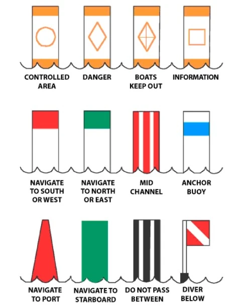
Non‑Lateral Markers (Regulatory & Informational)
These markers provide warnings, restrictions, or helpful information. They are typically white with orange symbols.
⛔ Danger Marker (Diamond)
Indicates hazards such as:
- Rocks
- Shoals
- Dams
- Wrecks
🚫 Restricted Area (Circle)
Indicates:
- No wake zones
- Speed limits
- No entry zones
Information Marker (Square)
Provides helpful info such as:
- Directions
- Marina locations
- Distances
Exclusion Area (Diamond with Cross)
Areas where boats are not allowed, such as:
- Swimming zones
- Dams
- Military areas
Special Purpose Buoys
These buoys serve unique functions beyond channel navigation.
🟡 Yellow Buoys
- Indicate special areas
- Examples: fishing zones, dredging areas, military operations
⚓ Mooring Buoys
- White with a blue horizontal band
- Only buoys you may legally tie up to
🟠 Safe Water Markers
- Red and white vertical stripes
- Indicate safe water all around
⚫ Isolated Danger Markers
- Black and red bands
- Mark hazards with safe water surrounding them
Comparison Chart: Marine Navigational Markers & Meanings
| Marker Type | Color/Shape | Meaning | Notes |
|---|---|---|---|
| Red Nun Buoy | Red, cone-shaped | Right side of channel returning | Even numbers |
| Green Can Buoy | Green, cylindrical | Left side of channel returning | Odd numbers |
| Preferred Channel (Red/Green) | Red over green | Preferred channel to port | Junction marker |
| Preferred Channel (Green/Red) | Green over red | Preferred channel to starboard | Junction marker |
| Danger Marker | White, orange diamond | Hazard present | Do not pass close |
| Restricted Marker | White, orange circle | Speed/no-wake restrictions | Follow posted rules |
| Information Marker | White, orange square | Helpful info | Non-regulatory |
| Exclusion Marker | White, orange cross | No entry | Swimming/dam areas |
| Mooring Buoy | White with blue band | Tie-up allowed | Only legal buoy to moor |
| Safe Water Marker | Red/white stripes | Safe water all around | Often marks channel entrance |
| Isolated Danger | Black/red bands | Hazard with safe water around | Approach with caution |
| Yellow Buoy | Yellow | Special purpose area | Check chart for meaning |
Sources: United States Coast Guard | Boating Safety ilearntoboat.com
Tips for Reading Markers Like a Pro
- Always remember Red Right Returning.
- Match buoy numbers to chart numbers for precise navigation.
- At night, rely on light colors and flashing patterns.
- Use caution around any orange‑symbol marker.
- Keep a printed or digital ATON reference onboard.
Final Thoughts
Mastering navigational markers is essential for safe, confident boating. With this guide—and a little time on the water—you’ll quickly learn to read markers like second nature.